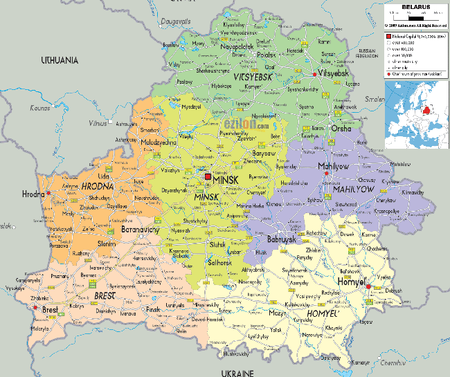
Geography of Belarus
Belarus, a generally flat country (the average elevation is 162 meters above sea level) without natural borders, occupies an area of 207,600 square kilometers, or slightly smaller than the state of Kansas. Its neighbors are Russia to the east and northeast, Latvia to the north, Lithuania to the northwest, Poland to the west, and Ukraine to the south.

Over 70% of Belarus's population of 9.5 million resides in urban areas. More than 80% of the population is ethnic Belarusian, with sizable minorities of Russians, Poles and Ukrainians.
Its capital is Minsk; other major cities include Brest, Hrodna (Grodno), Homiel (Gomel), Mahilyow (Mogilev) and Vitsebsk (Vitebsk). Over 40% of its 207,600 square kilometres (80,200 sq mi) is forested, and its strongest economic sectors are service industries and manufacturing.
Belarus's 3,000 streams and 4,000 lakes are major features of the landscape and are used for floating timber, shipping, and power generation. Major rivers are the west-flowing Western Dvina and Nyoman rivers, and the south-flowing Dniapro River with its tributaries, Berezina River, Sozh, and Prypyat rivers. The Prypyat River has served as a bridge between the Dnepr flowing to Ukraine and the Vistula in Poland since the period of Kievan Rus'. Lake Narach, the country's largest lake, covers eighty square kilometers.
